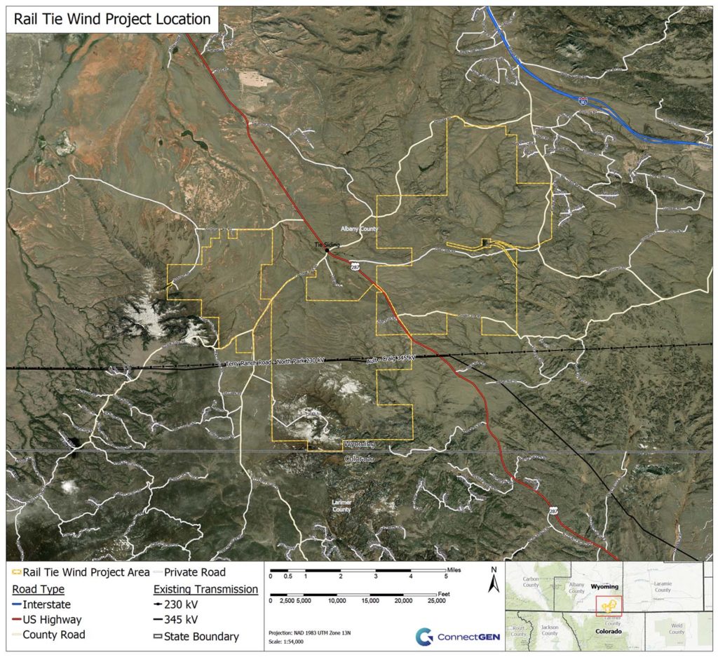
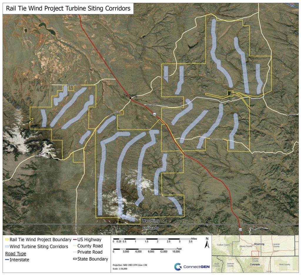
The Rail Tie Wind Project will be located in southeastern Albany County on private and state lands near Highway 287 outside of Tie Siding.  On this page, you will find a detailed map of the project area, a detailed map of the wind turbine siting corridors, and visual simulations that were developed to provide a photographic representation of what the project may look like from various viewpoints.

Rail Tie Wind Project Area

The Project Area boundary encompasses approximately 26,000 acres of private and state ranchland.

Click to view

Rail Tie Wind Project Turbine Siting Corridors

Wind turbines and other project facilities will be sited within the Project Area to comply with county setback distances, turbine spacing requirements, and other environmental and siting constraints. To support the environmental review of the project, ConnectGen has developed 1,000-foot wide turbine siting corridors within which turbines could be located.

Click to view

Visual Simulations

As part of the environmental review being performed for the proposed Rail Tie Wind Project, visual simulations were developed to provide a photographic representation of what the project may look like. Visual simulations were developed for several Key Observation Points (KOPs) in and around the project area. Because ConnectGen has not yet selected a turbine model for the Rail Tie Wind Project, two sets of visual simulations were created for each KOP – one depicting the proposed minimum turbine height scenario and one depicting the proposed maximum turbine height scenario. The photos used for the simulations were captured during the fall of 2019. The wind turbine locations depicted in the visual simulations reflect representative turbine layouts and are subject to change based on final engineering and environmental review.

This website uses cookies to improve your experience on our site. By using clicking ‘accept’ you consent to the use of cookies. Learn more.